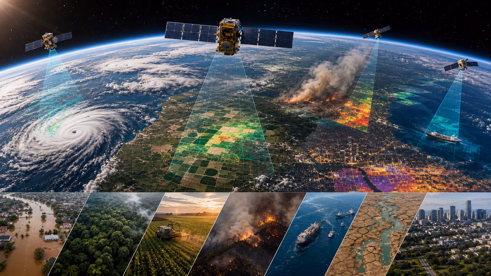
Earth observation is one of the most useful parts of the space economy and one of the easiest to miss. It does not always feel like space because the result arrives as a weather map, crop report, shipping estimate, fire alert, insurance model, climate record, or news image. A satellite passes overhead, measures something, and the data becomes a decision on the ground.
The basic idea is simple: from orbit, you can see patterns that are hard to see from one place on Earth. Clouds move across oceans. Smoke spreads across states. Crops change color before yields fall. Sea ice shifts. Cities heat differently block by block. Ships move through chokepoints. Forests dry out. Floods cover roads. Satellites turn distance into perspective.
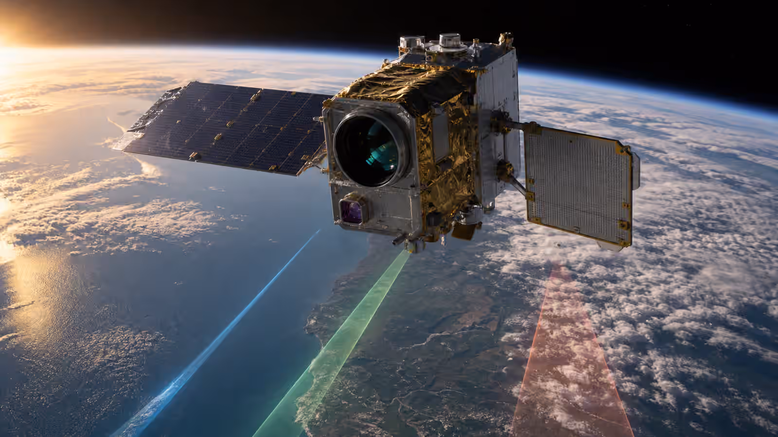
Different sensors see different worlds
Not all Earth observation satellites see the same thing. Optical sensors see reflected sunlight, producing images that may look like photographs. Infrared sensors can measure heat and vegetation signals. Radar satellites can see through clouds and work at night by sending signals down and measuring the return. Microwave sensors can help with moisture, sea ice, and atmospheric information. Hyperspectral sensors split light into many narrow bands, revealing material clues invisible to normal cameras.
The analogy is a doctor’s toolkit. A thermometer, X-ray, blood test, and stethoscope all reveal different things. No single sensor tells the whole story. The value comes from choosing the right measurement and combining it with ground truth, models, and local knowledge.
Weather and disasters
Weather forecasting is one of the clearest public benefits of space. Satellites watch storms form, track clouds, measure water vapor, and feed models that predict what happens next. Without satellite observations, modern forecasting would be weaker, especially over oceans where ground sensors are sparse.
Disaster response is another major use. After hurricanes, floods, earthquakes, fires, or volcanic eruptions, satellite imagery can show damaged roads, flooded neighborhoods, burn scars, smoke plumes, and where help may be needed. Radar can be especially useful when clouds block optical images. The faster responders understand the scene, the faster they can act.
Earth observation does not replace local emergency work. It gives local teams a wider map.
Farms, forests, and water
Farmers and agricultural companies use satellite data to monitor crop health, soil moisture, irrigation, drought stress, and harvest timing. A field may look fine from a road while satellite measurements show stress developing in one section. That can guide irrigation, fertilizer, scouting, or insurance.
Forests can be monitored for logging, disease, fire risk, regrowth, and carbon estimates. Water managers can track snowpack, reservoir levels, drought, floods, and land subsidence. These uses matter because land and water decisions are often spread across large areas. Satellites provide repeated observations instead of one-time snapshots.
The data is not perfect. Clouds, resolution, revisit time, sensor calibration, and interpretation all matter. A satellite image becomes useful when paired with models and people who understand the place.
Business and climate
Businesses use Earth observation for shipping, mining, construction, commodities, insurance, and supply chains. A company may watch port congestion, crop conditions, oil storage shadows, road building, or storm disruption. Governments use satellite data for security, treaty monitoring, environmental enforcement, and planning.
Climate science depends heavily on long-term observations. Satellites measure sea level, ice, vegetation, atmospheric composition, ocean color, land temperature, and more. The planet is too large and dynamic to understand from ground stations alone. A stable satellite record becomes part of humanity’s memory.
This is where Earth observation becomes more than a commercial service. It is part of how civilization knows what is happening to its home.
Privacy and power
Seeing Earth from space raises social questions. High-resolution imagery can reveal activity that people did not expect to be observed. Governments and companies may use data in ways that affect markets, borders, policing, or insurance. Even when images are legal, responsible use matters.
There is also an access question. If only wealthy institutions can afford the best data, the benefits are uneven. Open government data has been enormously important because it lets researchers, journalists, nonprofits, cities, and companies build useful tools. Commercial data adds detail and speed, but public data keeps the foundation broad.
Why this matters
Earth observation matters because good decisions need good sight. Weather warnings, crop planning, wildfire response, climate science, shipping, insurance, conservation, and public safety all improve when we can observe the planet repeatedly and objectively.
For a normal reader, the useful habit is to ask what a satellite is measuring, how often it returns, how clear the view is, and who turns the data into action. A beautiful image is only the beginning. The real value appears when the image helps someone decide where to send a fire crew, when to irrigate, how to route a ship, whether a forest is recovering, or how a storm is moving. Space becomes everyday infrastructure when orbital perspective becomes ground-level judgment.
The best Earth observation systems also admit uncertainty. A satellite may see a signal that suggests crop stress, but a farmer still knows the field. A flood map may show likely water extent, but responders still need reports from roads and neighborhoods. A climate trend may be clear in the data, while local impacts vary. Space data is powerful because it widens the view, not because it removes the need for human judgment. The premium version of Earth observation is not just sharper pictures. It is better decisions made with better context.